Guadalupe Mountains National Park is only a few dozen miles south of Carlsbad Caverns, just over the state line into Texas. In fact, the closest place to stay in this rather sparsely populated area is Carlsbad, NM. While Carlsbad Caverns NP focuses on the wonders underneath the Guadalupe Mountains, this park allows you explore them from above, in the desert sun.
Guadalupe Peak
After hiking to the top of Emory Peak, the highest point in Big Bend, I wanted to try the more difficult trek to the top of Guadalupe Peak, the highest point in Texas. At 8749 feet, it's not an incredibly high mountain, but it is a worthwhile hike!
Starting near the main visitor center, the hike to the peak is about 8 and a half miles out and back. A towering, imposing wall looms directly in front of you when you start the hike, blocking your view of the peak. The beginning of the hike shoots up this wall on a long series of switchbacks. The hike gains elevation very quickly in the first mile and a half, and is very tiring. Take it slow, and the trail, though it keeps ascending steadily, levels out and becomes easier higher up. I should note that there is a horse trail that sidetracks around the steepest, rockiest part of the main trail. It is a mile longer, but easier. I'd recommend just staying on the main trail (unless, of course, you're on a horse).
Once you reach the top of the initial wall, the trail loops you around its northern side. From here, the hike becomes steadily more scenic as you wander through the changing flora of higher elevations and along ridges with increasingly wide views. The trail reaches a false summit, descends a bit, crosses a short wooden bridge, and ascends the short distance to the summit. There are incredible views here, especially this one looking down onto El Capitan, a striking peak from both above and below:
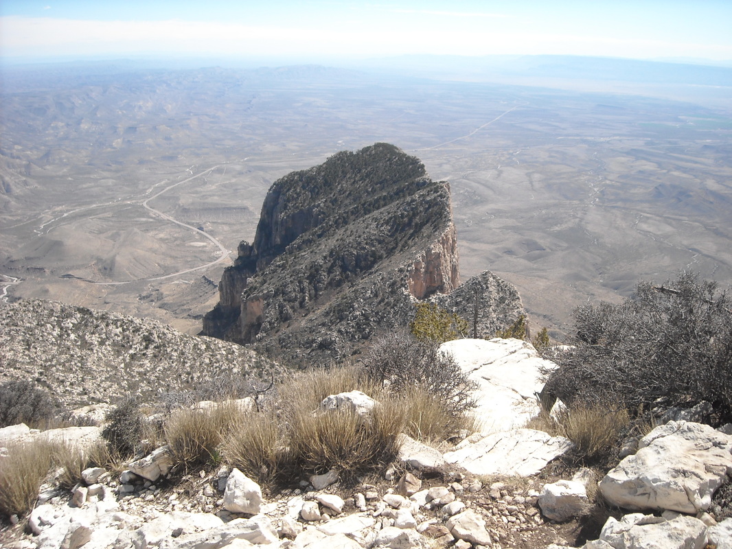
The hike starts all the way down there on the desert floor, 3000 feet below. Soon after this, the path arrives at the summit:
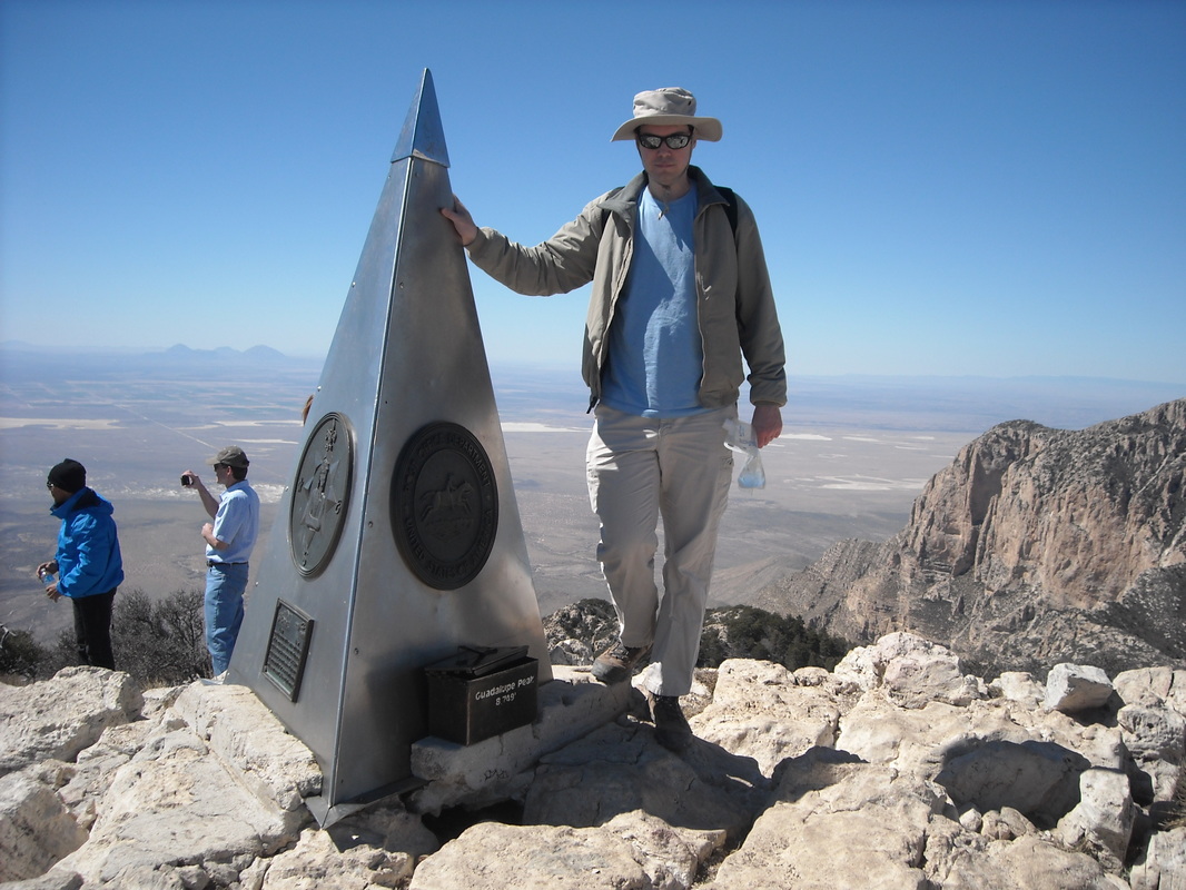
There's a register book here on the peak, and this strange metal pyramidal monument, which was put there by an airline company before this area was a national park.
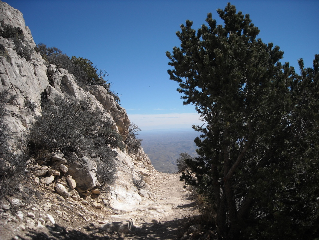
On the way back down, the trail seems to lead straight into the sky!
On the way back down, the trail seems to lead straight into the sky!
Devil's Hall
On the way back down from Guadalupe Peak, I took a side path to visit the Devil's Hall, a neat looking slot canyon. The path involves a hike/scramble up a boulder-filled creek bed. From the trailhead, this hike is just over 4 miles, but as a side hike from Guadalupe Peak's horse trail, it only added 2 miles.
After the hike up the streambed, I came to the Hiker's Staircase, a natural rock staircase.
After the hike up the streambed, I came to the Hiker's Staircase, a natural rock staircase.
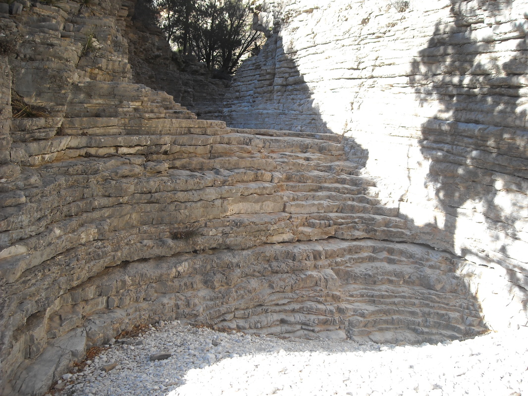
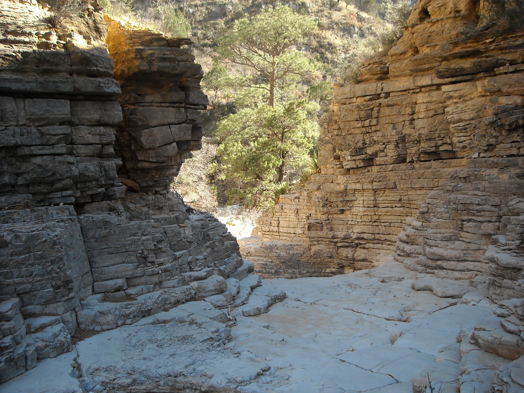
The Hiker's Staircase leads into Devil's Hall, a small, eerie slot canyon with black pools:
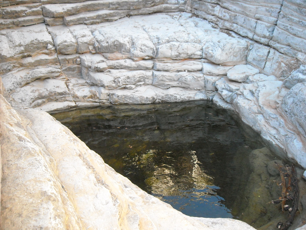
...And full of jutting right angles which barely look natural.
McKittrick Canyon Trail
McKittrick Canyon is often called the best hike in Texas. While I have to respectfully disagree (Marufo Vega, South Rim, Lost Mine, and Guadalupe Peak are also in Texas), it is a lovely hike along an intermittent stream, an area which is a little greener than the rest of the desert. It gives me an excuse to use the word "riparian", which describes an ecosystem near a stream or river.
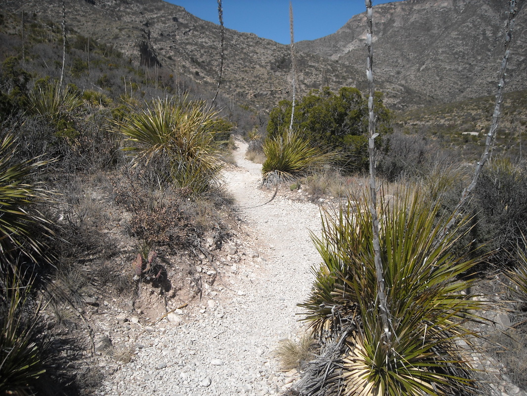
This is the start of the trail, winding through the desert:
This is the start of the trail, winding through the desert:
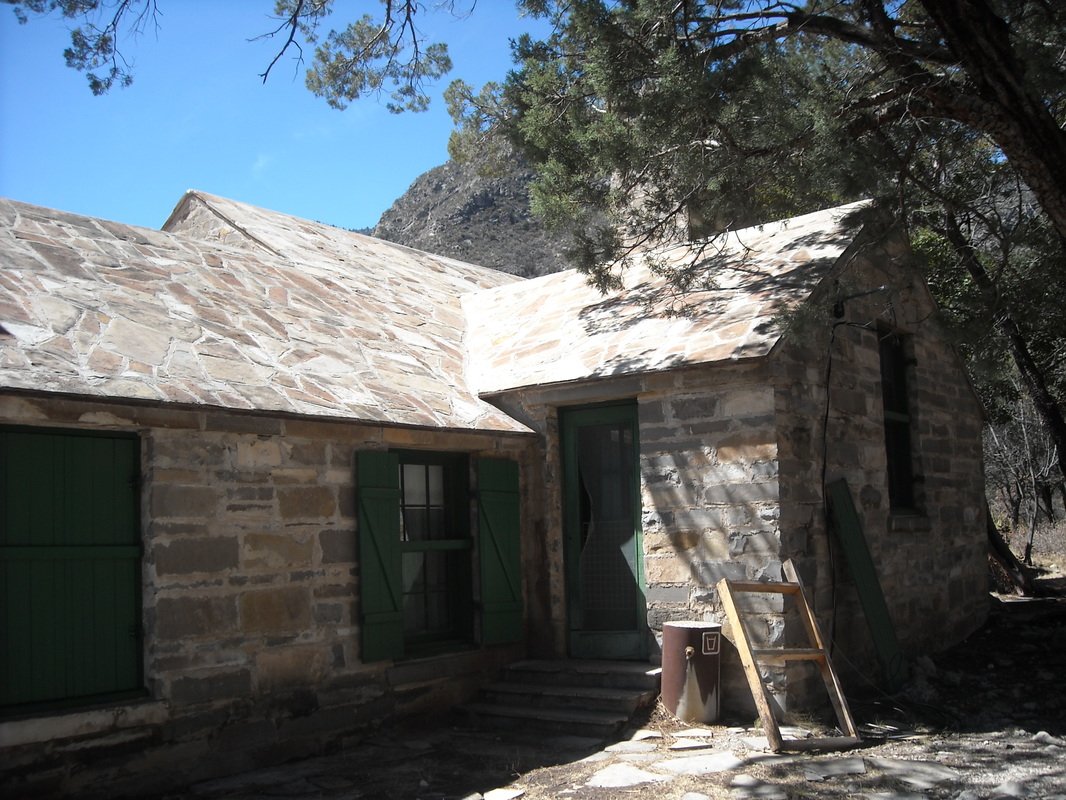
The trail passes Pratt Cabin after a little over 2 miles, whose roof is even made of stone:
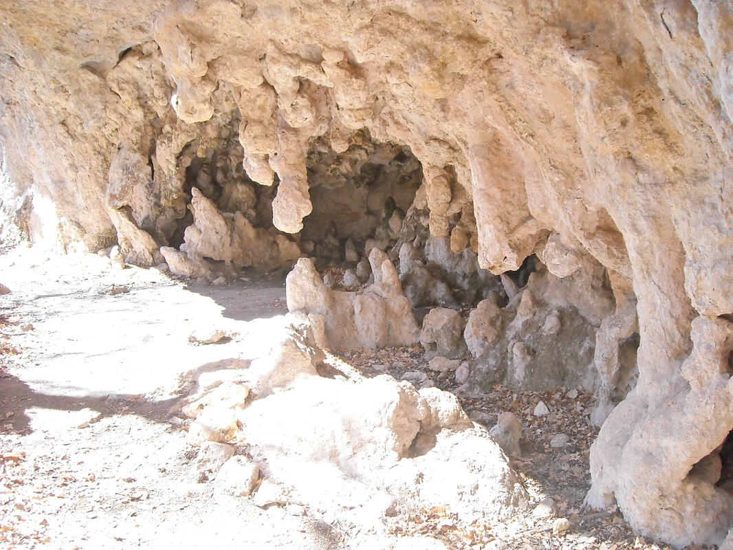
About 3 and a half miles in, a short spur leads to the Grotto, a small cave with formations:
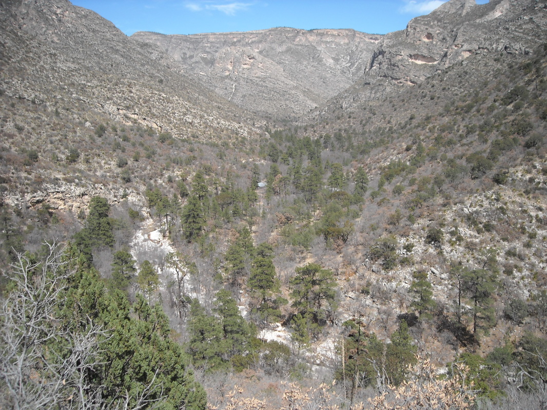
From the Grotto, the trail ascends to the notch, offering great views back down into the canyon:
The trail continues past the notch, though I turned around. Next time I'd like to go further!
I wanted to hike to The Bowl the following day, but it was pouring rain and horribly, miserably cold. (This was in March.) Instead, I walked into Carlsbad Caverns, which is the same temperature all the time.
I wanted to hike to The Bowl the following day, but it was pouring rain and horribly, miserably cold. (This was in March.) Instead, I walked into Carlsbad Caverns, which is the same temperature all the time.
Hunter Peak / The Bowl


Lost Peak / Manzanita Ridge


